NOBC31 Port Simpson - Northern BC
Backroad Mapbooks
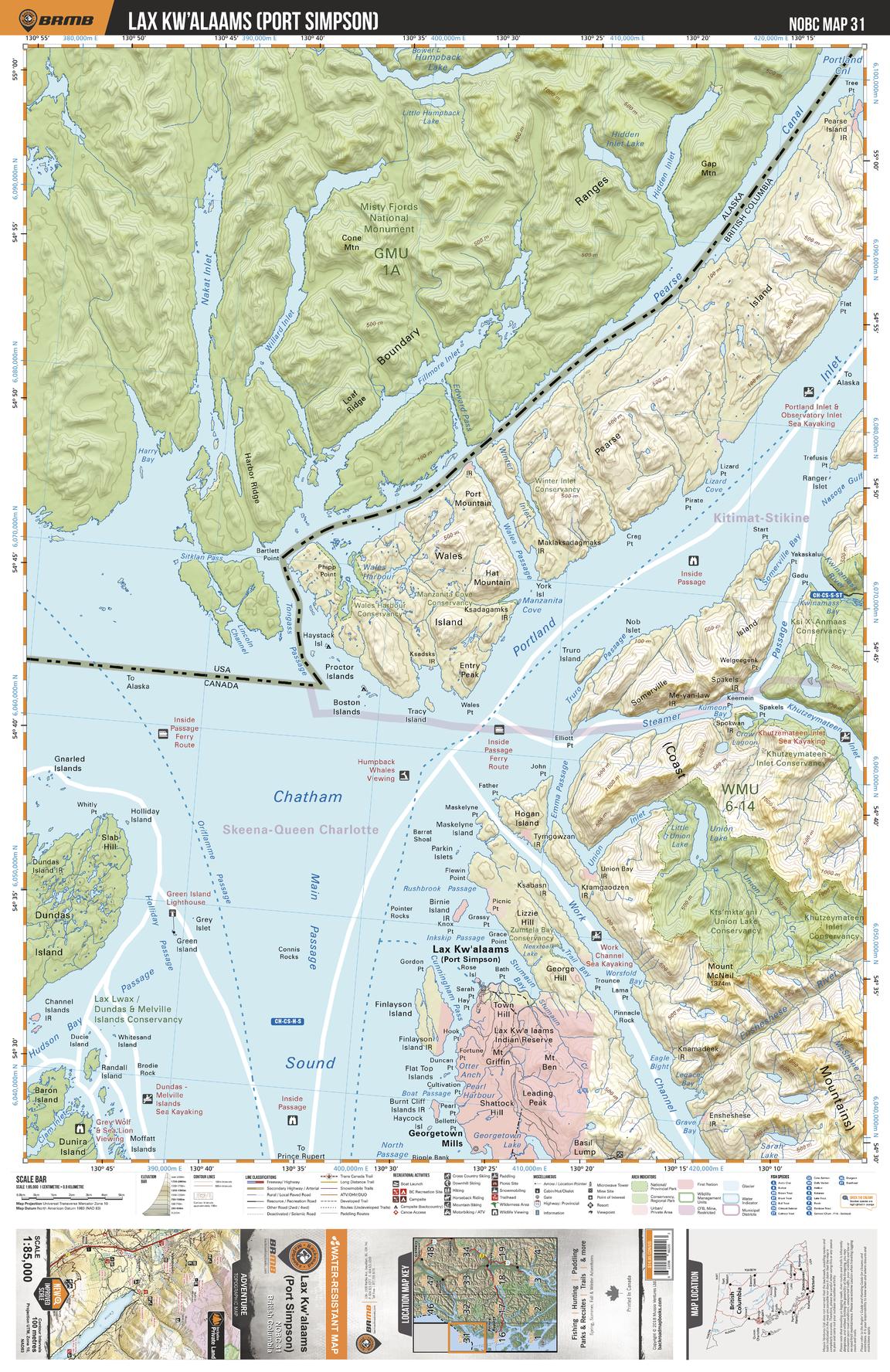
This recreation topographic map for the Port Simpson area highlights all the logging roads, trails and recreation features for fishing, hunting, camping, hiking, mountain biking, canoeing, kayaking, backcountry skiing, wildlife viewing, ATVing, snowmobiling and more. No other map for the area provides you this level of recreational and topographic detail. New features include private land and labelled fish species plus countless new roads, trails and recreational Points of Interest. Covering Willmore Wilderness Prov Park, Morkill River, Pearse Island, Wales Island, Lax Kw`alaams (Port Simpson), Work Channel, Chatham Sound, Dundas Island, Somerville Island, Portland Inlet and more, this map contains new features such as private land and labelled fish species. This 1:85,000 scale map covers 3,040 km2 (1,175 mi2), measuring 50 x 63.5 km (30 x 39.5 mi).
Page Size: 24 x 37 in (610 x 940 mm)
Buy this map on MapTrove.ca