NOBC116 McBride Area East - Northern BC Topo
Backroad Mapbooks
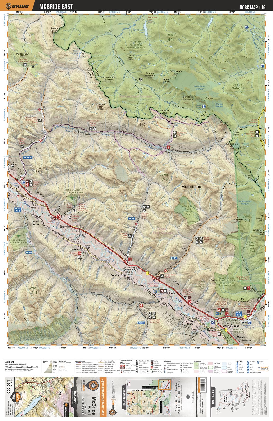
This recreation topographic map for McBride and the Robson Valley features all the logging roads, recreational features and trails for hiking, mountain biking, ATVing, snowmobiling, skiing, snowshoeing, fishing, camping, hunting, canoeing, kayaking, wildlife viewing and more. New features include private land and labelled fish species, plus new roads, recreational trails and Points of Interest. No other map provides you with this level of recreational and topographic detail for the McBride area. Measuring 104 x 69 km (64.5 x 43 mi), this map covers 7,135 km2 (2,755 mi2) in total, including Crescent Spur, Dunster, Goat River, Harvey, Isaac Lake, McBride, Mt. Renshaw, Lamming Mills, McCabe, Poser, Raush Valley, and Tete Jaune Cache, along with Bowron Lake Provincial Park, Small River Caves Provincial Park, West Twin Provincial Park, Willmore Wilderness Provincial Park and more.
Page Size: 24 x 37 in (610 x 940 mm)
Buy this map on MapTrove.ca