NOBC114 Gwaii Haanas Park Reserve - Northern BC
Backroad Mapbooks
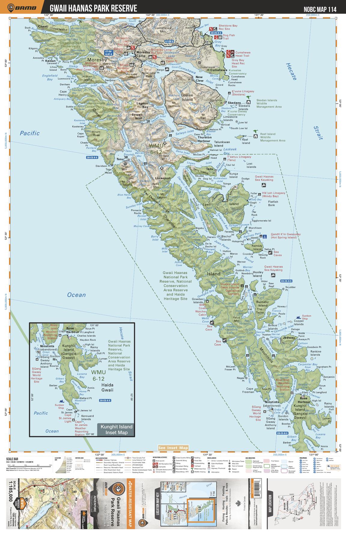
This recreation map for the Gwaii Haanas Park Reserve area highlights all the logging and resource roads, recreational features and trails for hiking, mountain biking, ATVing, snowmobiling, skiing, snowshoeing, fishing, camping, hunting, canoeing, kayaking, wildlife viewing and more. New features include private land and labelled fish species, plus new roads, recreational trails and Points of Interest. No other map for the area provides you with this level of recreational or topographic detail. Measuring 105 x 140 km (65 x 87 mi), this 1:185,000 scale map covers 14,750 km2 (5,695 mi2) in total and includes Moresby Island, Lagoon Bay, Rose Harbour, Gwaii Hanaas National Park Reserve, Tanu, Jedway, Mosquito Lake, Thurston Harbour, New Clew, Cheatl and more!
Page Size: 24 x 37 in (610 x 940 mm)
Buy this map on MapTrove.ca