NLNL73 Cartwright - Newfoundland and Labrador Topo
Backroad Mapbooks
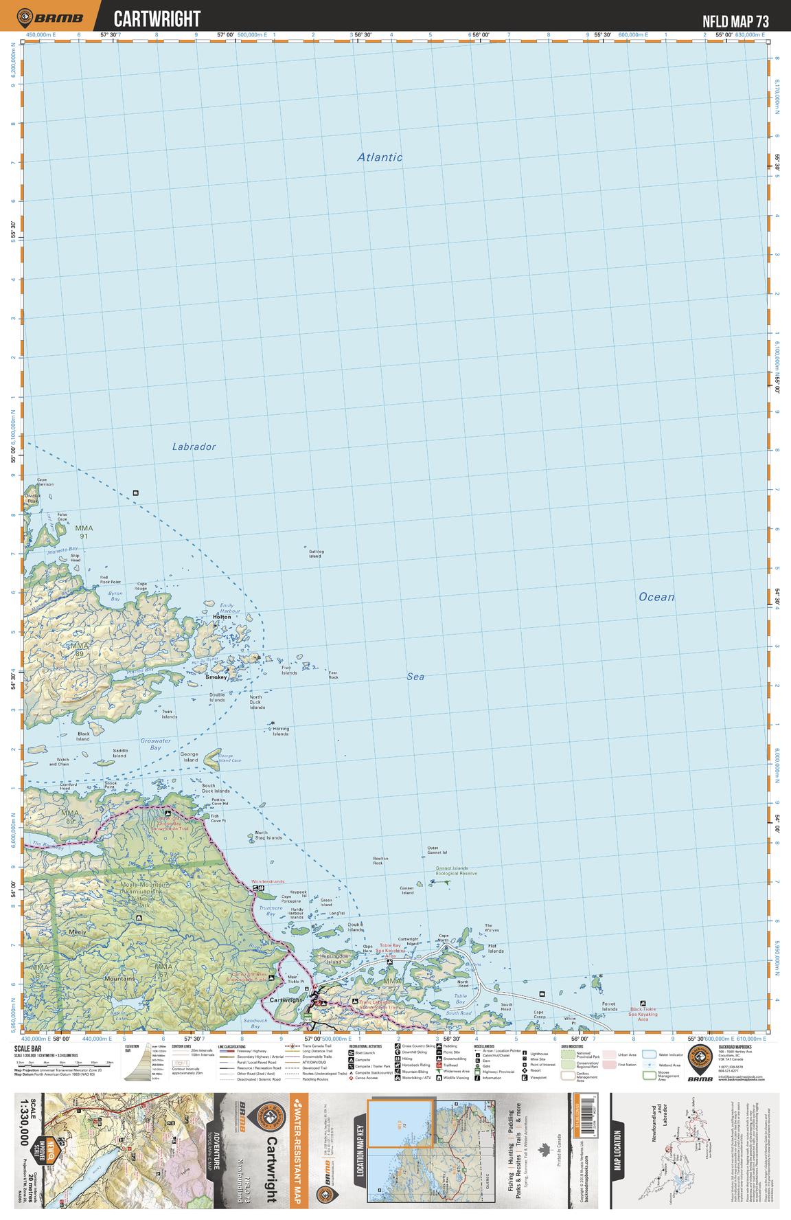
This recreation topographic map for Cartwright Labrador highlights all the logging/resource roads, hunting areas, fishing lakes & streams, campsites, paddling routes for canoeing and kayaking, wildlife viewing areas, multi-use trails for hiking, biking, horseback riding, cross-country skiing and snowshoeing, motorized trails for ATVing and snowmobiling & more. Covering 49,475 km2 (19,100 mi2), this 1:330,000 scale map measures 193 x 256.5 km (120 x 159 mi), providing you with more topographic and recreational detail for the Fortune area than any other map on the market. Special features include countless roads, trails and recreational Points of Interest. Included on this map are Cartwright, Pottles Bay, Groswater Bay, The Blackway, Mealy Mountain, Barron Lake, Sandwich Bay, North River and more!
Page Size: 24 x 37 in (610 x 940 mm)
Buy this map on MapTrove.ca