NEON98 Peawanuck - Northeastern Ontario Topo
Backroad Mapbooks
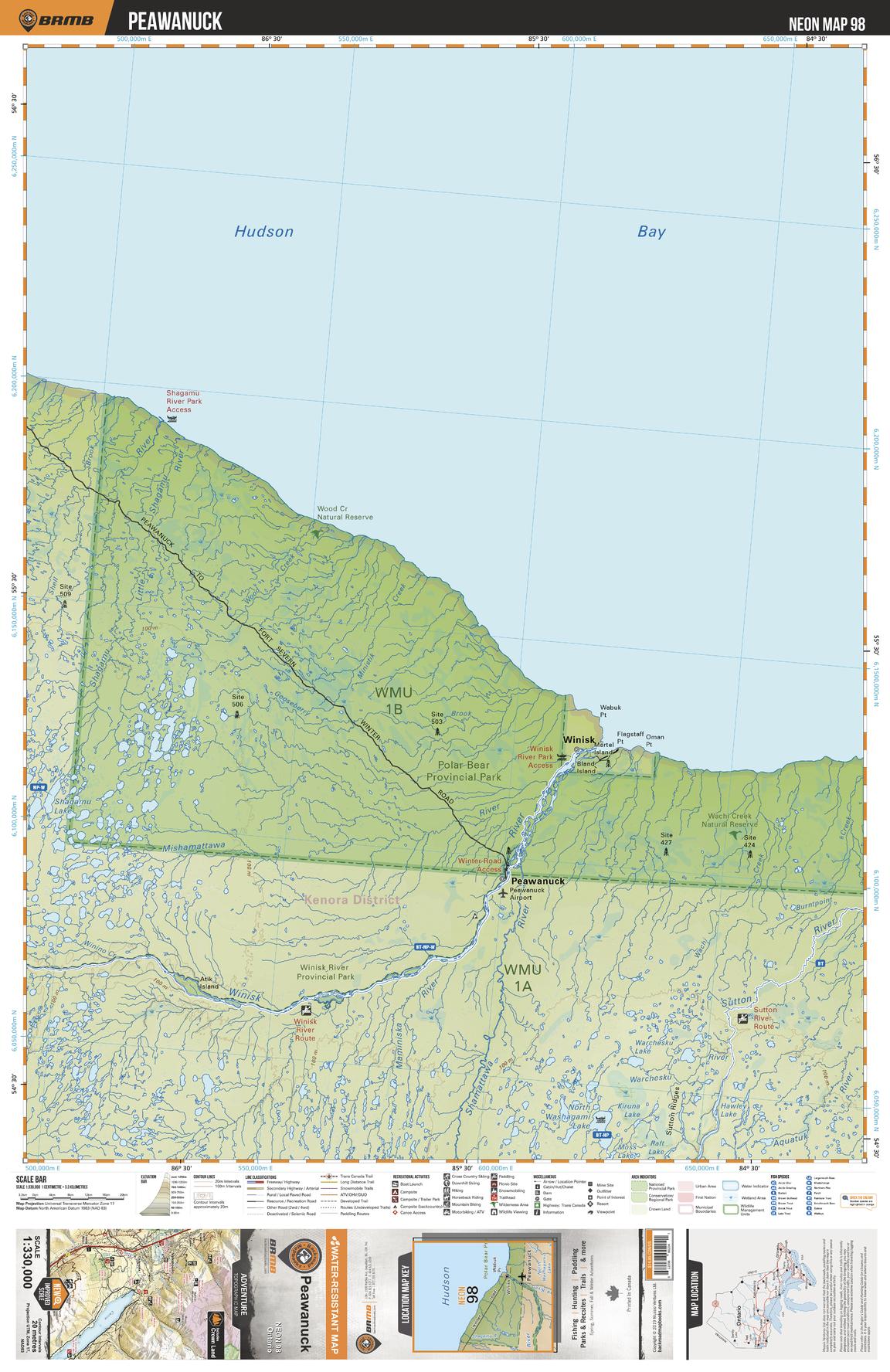
This recreation topographic map for Peawanuck highlights all the logging/resource roads, hunting areas, fishing lakes & streams, campsites, paddling routes for canoeing and kayaking, wildlife viewing areas, multi-use trails for hiking, biking, horseback riding, cross-country skiing and snowshoeing, motorized trails for ATVing and snowmobiling & more. Covering 48,670 km2 (18,890 mi2), this 1:330,000 scale map measures 191 x 254 km (119 x 158 mi), providing you with more topographic and recreational detail for the Ogoki area than any other map on the market. New features include Crown land areas, countless new roads and trails plus additional recreational Points of Interest. Included on this map are Hudson Bay, Winisk River Prov Park, Winisk River, Shamattawa River, Peawanuck, Winisk, Polar Bear Prov Park, Sutton River and more!
Page Size: 24 x 37 in (610 x 940 mm)
Buy this map on MapTrove.ca