MBMB84 Gillam - Manitoba Backroad Mapbook Topo
Backroad Mapbooks
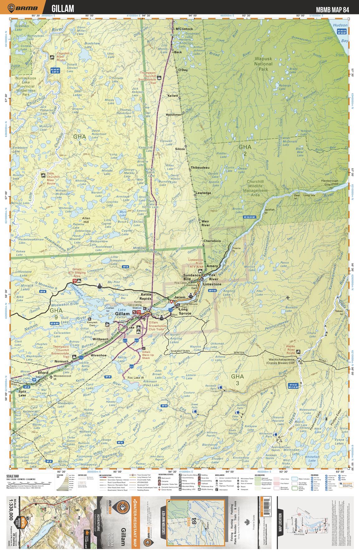
This recreation topographic map for Gillam highlights all the logging/resource roads, hunting areas, fishing lakes & streams, campsites, paddling routes for canoeing and kayaking, wildlife viewing areas, multi-use trails for hiking, biking, horseback riding, cross-country skiing and snowshoeing, motorized trails for ATVing and snowmobiling & more. Covering 49,475 km2 (19,100 mi2), this 1:330,000 scale map measures 193 x 256.5 km (120 x 159 mi), providing you with more topographic and recreational detail for the Gods Lake Narrows area than any other map on the market. New features include Crown land areas and labeled fish species, plus countless new trails, roads and recreational Points of Interest. Included on this map are Wapusk National Park, Churchill Wildlife Management Area, Stephens Lake, Nelson River, Gillam, Numaykoos Lake Prov Park, Ilford, Hayes River, Bigstone River, Bragshaw Lake and more!
Page Size: 24 x 37 in (610 x 940 mm)
Buy this map on MapTrove.ca