MBMB61 Birch River - Manitoba Backroad Mapbook Topo
Backroad Mapbooks
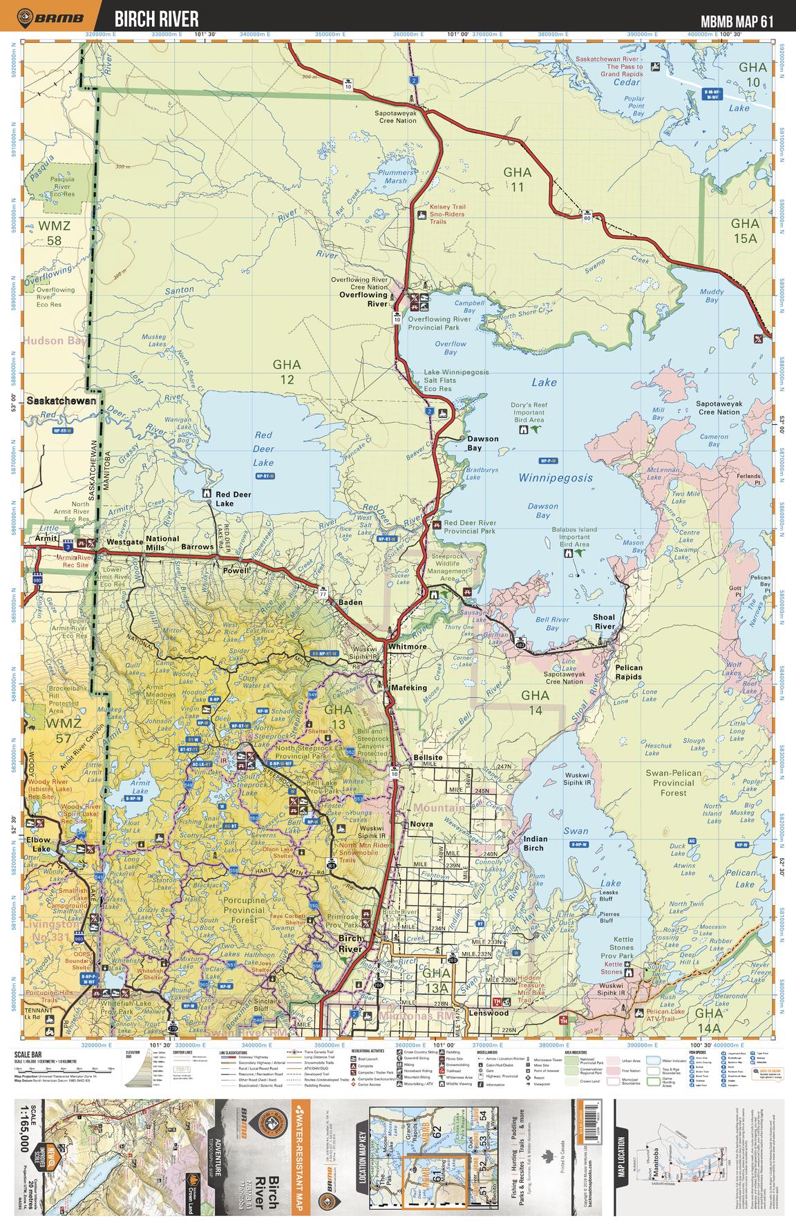
This recreation topographic map for Birch River highlights all the logging/resource roads, hunting areas, fishing lakes & streams, campsites, paddling routes for canoeing and kayaking, wildlife viewing areas, multi-use trails for hiking, biking, horseback riding, cross-country skiing and snowshoeing, motorized trails for ATVing and snowmobiling & more. Covering 12,370 km2 (4,775 mi2), this 1:165,000 scale map measures 96.5 x 128 km (60 x 79.5 mi), providing you with more topographic and recreational detail for the Birch River area than any other map on the market. New features include Crown land areas and labeled fish species, plus countless new trails, roads and recreational Points of Interest. Included on this map are Baden, Bell Lake Provincial Park, Bellsite, Birch River, Cedar Lake, Dawson Bay, Indian Birch, Kettle Stones Provincial Park, Lake Winnipegosis, Lenswood, Mafeking, North Steeprock Lake Provincial Park, Overflowing River, Pelican Rapids, Porcupine Provincial Forest, Red Deer Lake, Shoal River, Swan Lake, Whitefish Lake Provincial Park, Whitmore and more!
Page Size: 24 x 37 in (610 x 940 mm)
Buy this map on MapTrove.ca