KRBC35 Albert Canyon - Kootenay Rockies BC Topo
Backroad Mapbooks
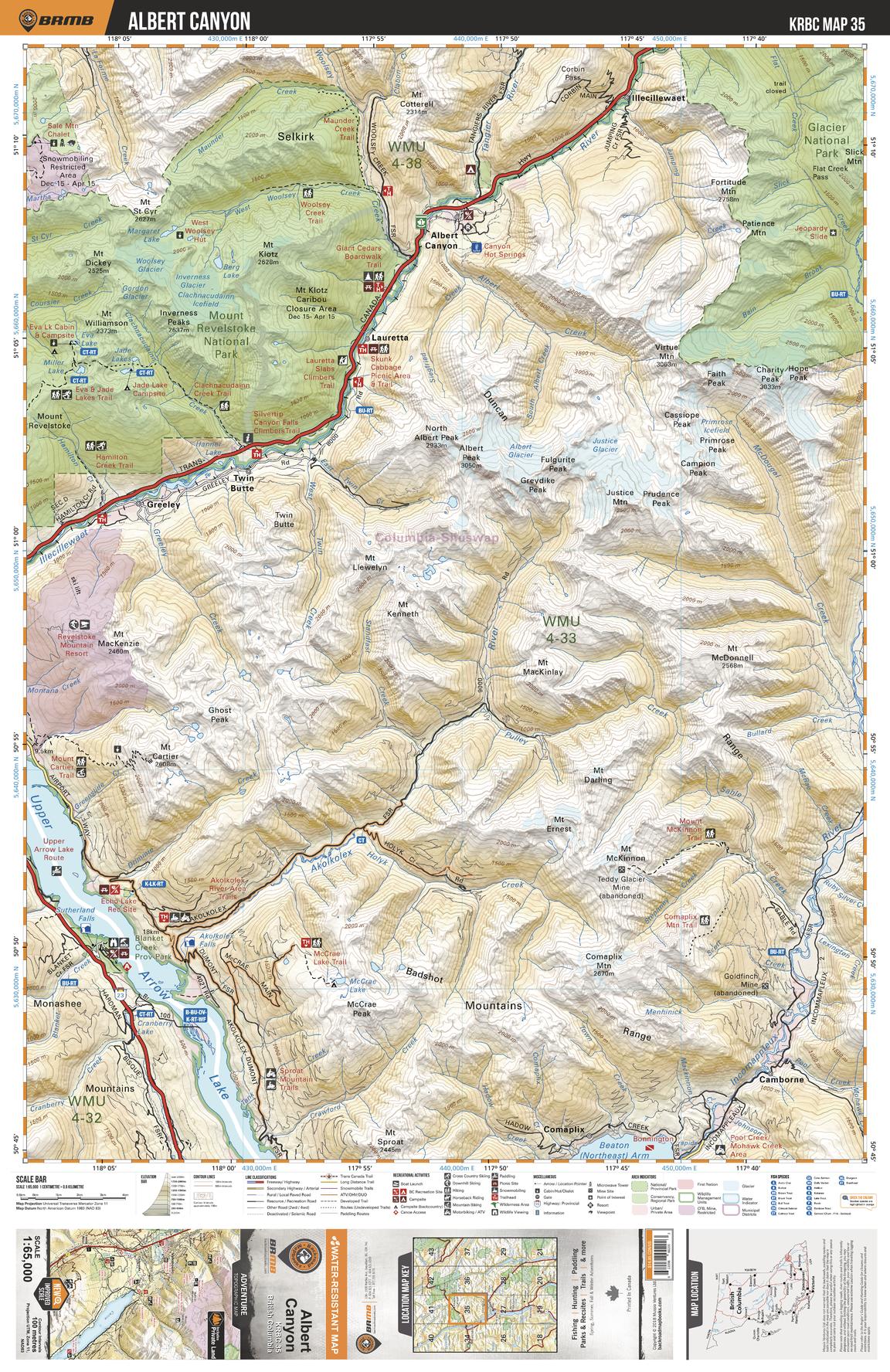
This recreation topographic map for the Albert Canyon area highlights all the logging and resource roads, multi-use trails for hikers, mountain bikers, horseback riders, cross-country skiers and snowshoers, motorized trails for ATVers and snowmobiles, fishing lakes and rivers, recreation areas, campgrounds, day-use areas, viewpoints, backcountry campsites, backcountry huts and cabins and more. No other map for the area provides you with this level of recreational or topographic detail. Special features include private land, labelled fish species and countless roads, trails and recreational Points of Interest. Covering 1,950 km2 (753 mi2), this 1:65,000 scale map measures 38 x 51 km (23.5 x 32 mi). This map includes Mount Revelstoke National Park, Albert Canyon, Greeley, Upper Arrow Lake, Camborne, Incomappleux River, Glacier National Park, Illecillewaet, Twin Butte, Lauretta and more!
Page Size: 24 x 37 in (610 x 940 mm)
Buy this map on MapTrove.ca