KRBC04 Stagleap Provincial Park - Kootenay Rockies BC Topo
Backroad Mapbooks
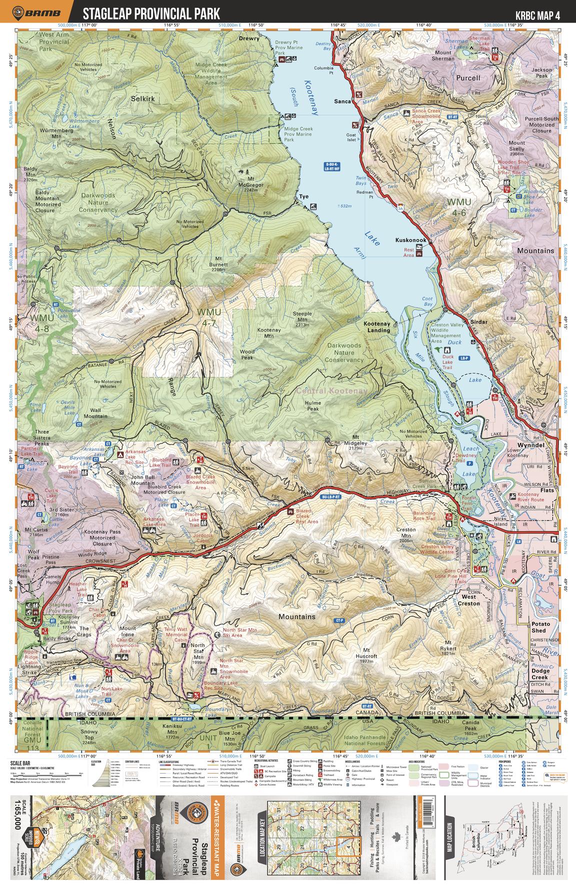
This recreation topographic map for the Stagleap Provincial Park area highlights all the logging and resource roads, multi-use trails for hikers, mountain bikers, horseback riders, cross-country skiers and snowshoers, motorized trails for ATVers and snowmobiles, fishing lakes and rivers, recreation areas, campgrounds, day-use areas, viewpoints, backcountry campsites, backcountry huts and cabins and more. No other map for the area provides you with this level of recreational or topographic detail. Special features include private land, labelled fish species and countless roads, trails and recreational Points of Interest. Covering 1,950 km2 (753 mi2), this 1:65,000 scale map measures 38 x 51 km (23.5 x 32 mi). This map includes Kootenay Lake, Darkwoods National Wildlife Area, Wynndel, Stagleap Prov Park, Leach Lake, Six Mile Slough, Dodge Creek, Duck Lake, Drewry, Kuskonook and more!
Page Size: 24 x 37 in (610 x 940 mm)
Buy this map on MapTrove.ca