CEAB18 Red Deer - Central Alberta Topo
Backroad Mapbooks
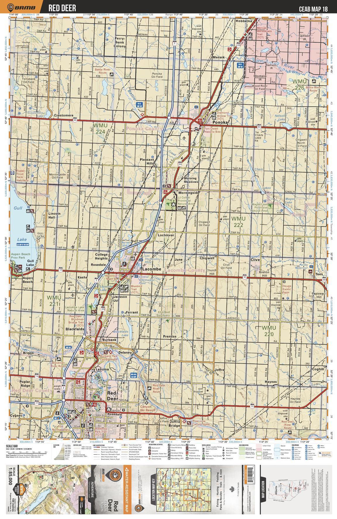
This recreation topographic map for Red Deer highlights all the logging and resource roads, multi-use trails for hikers, mountain bikers, horseback riders, cross-country skiers and snowshoers, motorized trails for ATVers and snowmobiles, fishing lakes and rivers, recreation areas, campgrounds, day-use areas, viewpoints, backcountry campsites, work camps, oil & gas sites, backcountry huts and cabins and more. No other map for the area provides you with this level of recreational or topographic detail. Covering 3,040 km2 (1,175 mi2) in total, this 1:85,000 scale map measures 48 x 63.5 km (30 x 39.5 mi). Special features include enhanced oil & gas data plus countless roads, trails and recreational Points of Interest. This map includes Gull Lake, Red Deer, Blackfalds, Lacombe, Morningside, Ponoka, Battle River, Red Deer River, Clive, Tees and more!
Page Size: 24 x 37 in (610 x 940 mm)
Buy this map on MapTrove.ca