CCON83 French River - Cottage Country Ontario Topo
Backroad Mapbooks
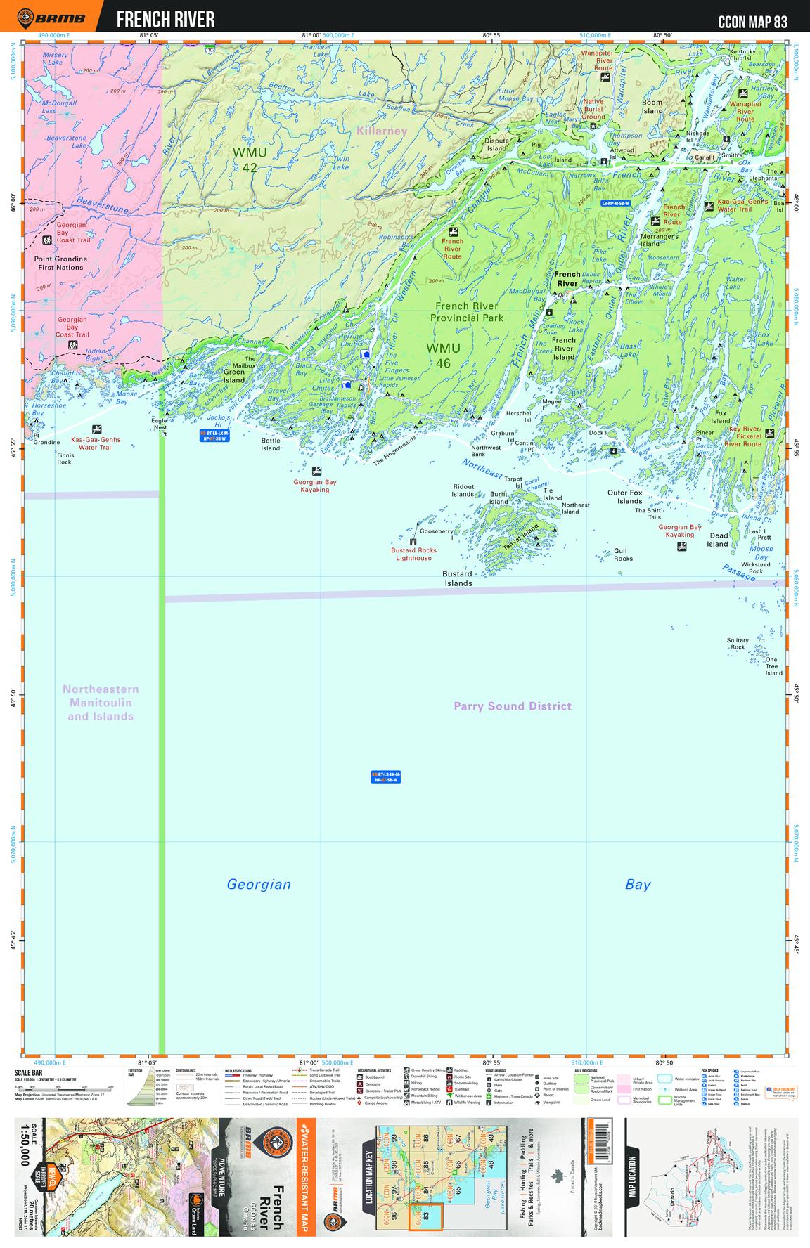
This recreation topographic map for French River highlights all the logging/resource roads, hunting areas, fishing lakes & streams, campsites, paddling routes for canoeing and kayaking, wildlife viewing areas, multi-use trails for hiking, biking, horseback riding, cross-country skiing and snowshoeing, motorized trails for ATVing and snowmobiling & more. Covering 1,090 km2 (420 mi2), this 1:50,000 scale map measures 29 x 38 km (18 x 24 mi), providing you with more topographic and recreational detail for the Richmond Hill area than any other map on the market. New features include enhanced Crown land, countless new roads and trails and a wealth of recreational Points of Interest. Included on this map are French River, Provincial, Georgian Bay, Wanapitei, Island, River and more!
Page Size: 24 x 37 in (610 x 940 mm)
Buy this map on MapTrove.ca