CCBC18 100 Mile House - Cariboo Chilcotin Coast BC Topo
Backroad Mapbooks
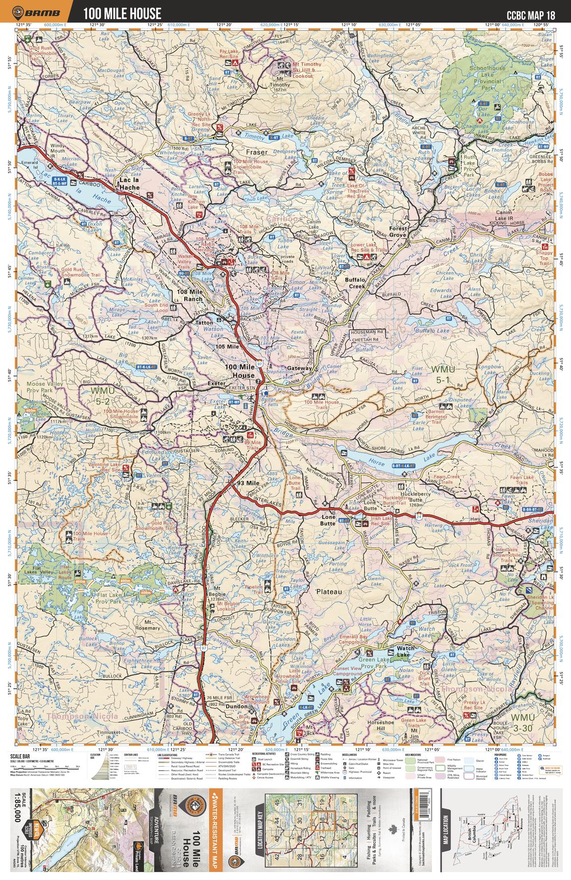
This recreation topographic map for the 100 Mile House area highlights all the logging roads, trails and recreational Points of Interest including hunting, camping, hiking, mountain biking, canoeing, kayaking, backcountry skiing, wildlife viewing, ATVing, snowmobiling and more. No other map provides you with this level of recreational and topographic detail for the Homathko River area. Covering the 100 Mile House, Green Lake, Flat Lake Prov Park, Watch Lake, Horse Lake, 108 Mile Ranch, Lac La Hache, Ruth Lake, Schoolhouse Lake Prov Park, Lone Butte and more, this map contains new features such as private land and labelled fish species. The 1:85,000 scale map covers 3,040 km2 (1,175 mi2), measuring 50 x 63.5 km (30 x 39.5 mi).
Page Size: 24 x 37 in (610 x 940 mm)
Buy this map on MapTrove.ca