top of page
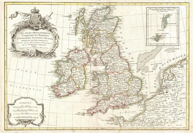
Zannoni Map of the British Isles: England, Scotland, Ireland (1771)
Artokoloro
1771 map of England, Scotland and Ireland by French geographer and cartographer Jean Janvier for Jean Lattre's 1783 final issue of the Atlas Moderne. Full title: Les Iles Britanniques Comprenant les Royaumes d'Angleterre d'Ecosse et d'Irelande divisés en grandes provinces Dréssés sur les Observations Astronomiques par le Sr. Janvier Géographe
Page Size: 17 x 11.75 in (427 x 295 mm)
Buy this map on MapTrove.ca or MapTrove.com
bottom of page