top of page
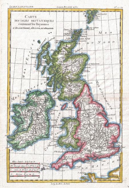
Raynal and Bonne Map of British Isles (1780)
Artokoloro
1780 map of the British Isles by Royal Cartographer to France Rigobert Bonne (1727 - 1794), one of the most important cartographers of the late 18th century. Full title: Carte des Iles Britanniques contenant les Royaumes d'Angleterre, d'Ecosee et d'Irelande.
Page Size: 9.5 x 13.75 in (239 x 347 mm)
Buy this map on MapTrove.ca or MapTrove.com
bottom of page