top of page
James Polar Projection of the Globe, Pacific Center (1860)
Artokoloro
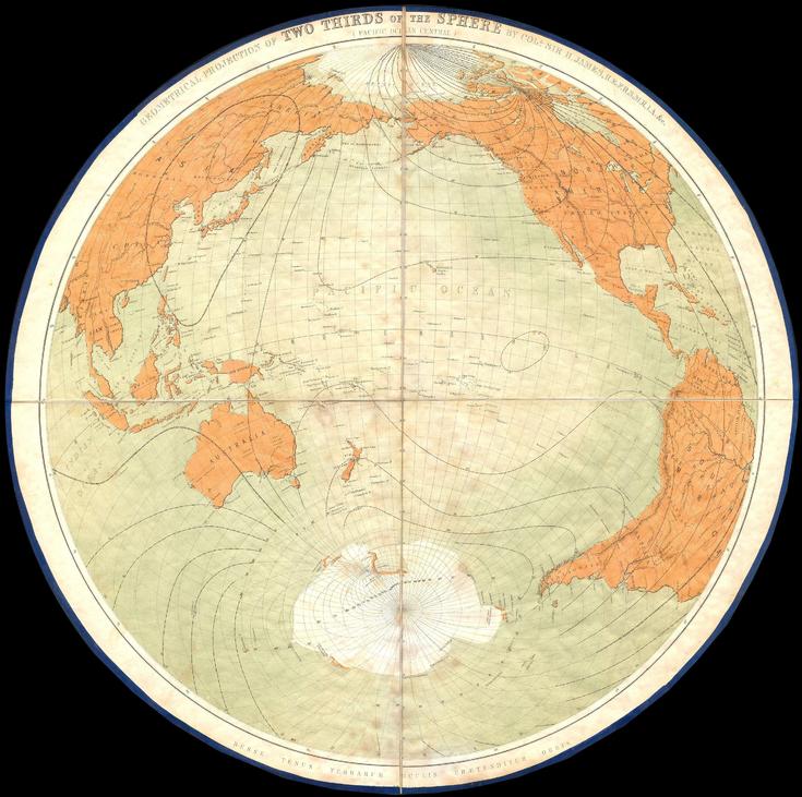
1860 polar projection map centered on the Pacific Ocean by director-general of the British Ordnance Survey Major General Sir Henry James. Full title: Geometrical Projection of Two Thirds of the Sphere by Col. Sir H. James, R.E.F.R.S: M.R.I.A: & c.
Page Size: 15.5 x 15.25 in (389 x 387 mm)
Buy this map on MapTrove.ca or MapTrove.com
bottom of page