


Meridian Maps
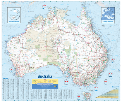
Australia Wall Map - 3rd Edition
An award winning map of Australia. Clearly marked on the map are all the nation’s top tourist sites, parks, and points of interest. This easy to read map includes Distance Grids, Time Zone Clocks and Weather Charts of all the capital cities. The map includes an inset maps of Australia’s Territories and a country comparison with Europe.
Page Size: 39.5 x 33.25 in (1000 x 840 mm)
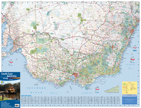
South East Australia Wall Map - 2nd Edition
This wall map of South East Australia coves the most populous corner of Australia. From Port Augusta in South Australia in the west, to Newcastle in New South Wales in the north, and all of Victoria in the south, this map is both large in size and breadth of area it covers. Designed to meet the needs of the business and travelling public who commute between the state capitals on a regular basis, the map provides excellent detail of the whole region, Includes, lists of towns, Distance Grid and Road Distance/Time Travel Guide.
Page Size: 38.75 x 29.75 in (980 x 750 mm)
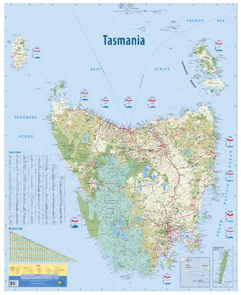
Tasmania, Australia State Wall Map
This wall map is unlike any other map of Tasmania. Packed with features, and a clean and easy to read design, it is an invaluable tool for business or home. Features of the map include all the states islands in the correct geographical location, Macquarie Island inset, all public land use and tourist sites shown.
Page Size: 35.25 x 43.25 in (895 x 1095 mm)
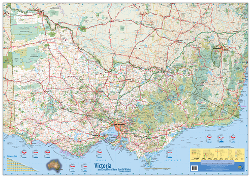
Victoria & Southern New South Wales Wall Map - 2nd Edition
This wall map of Victoria and southern New South Wales shows all the top tourist sites, parks and forests, camp grounds and points of interest. Clear and easy to read, this map is the ideal wall map of Victoria for business and planning. Includes Distance Chart and Weather Charts.
Page Size: 50 x 35.5 in (1270 x 900 mm)