NEON68 Joe Lake - Northeastern Ontario Topo
Backroad Mapbooks
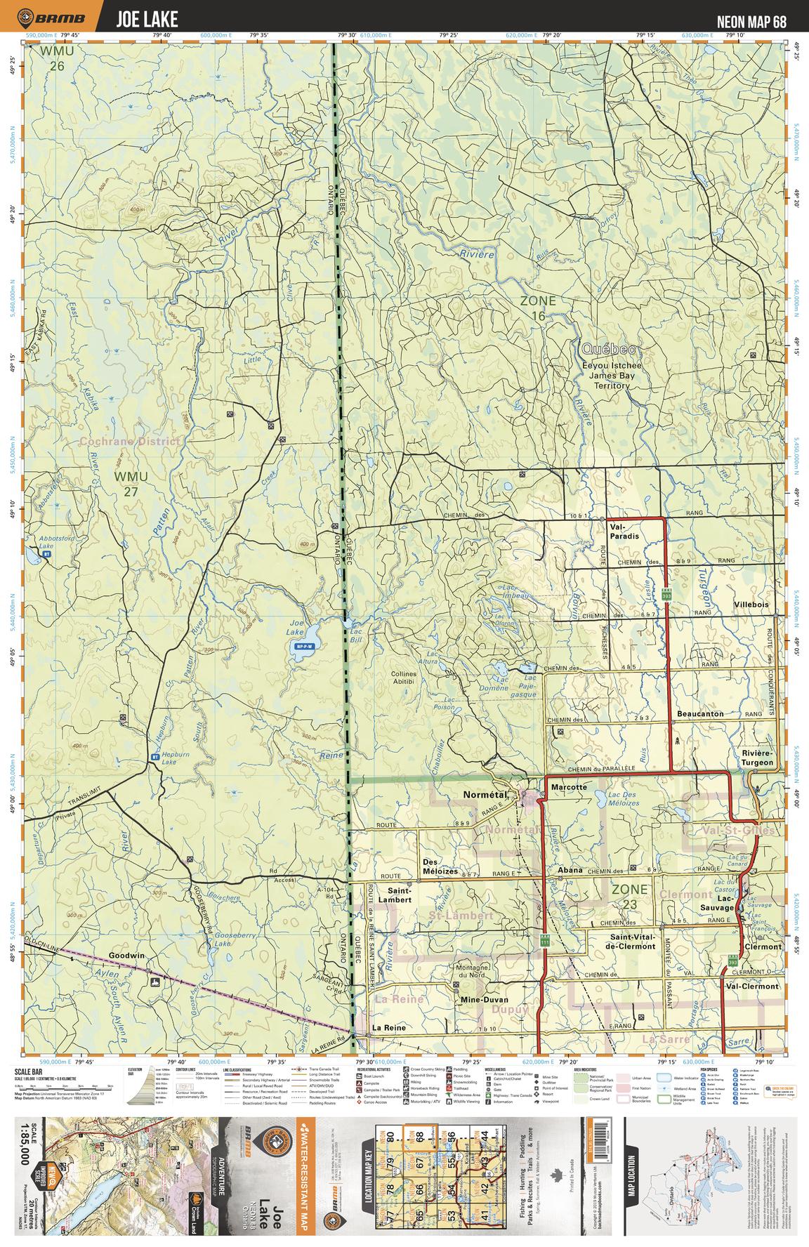
This recreation topographic map for Joe Lake highlights all the logging/resource roads, hunting areas, fishing lakes & streams, campsites, paddling routes for canoeing and kayaking, wildlife viewing areas, multi-use trails for hiking, biking, horseback riding, cross-country skiing and snowshoeing, motorized trails for ATVing and snowmobiling & more. Covering 3,040 km2 (1,170 mi2), this 1:85,000 scale map measures 48 x 63.5 km (30 x 39.5 mi), providing you with more topographic and recreational detail for the Meldrum Bay area than any other map on the market. New features include Crown land areas, countless new roads and trails plus additional recreational Points of Interest. Included on this map are Patten River, Goodwen, Aylen River, Joe Lake, Abbotsford Lake, Abbotsford Creek, East Kabika River, Little Clive River, Hepburn Lake, South Patten River and more!
Page Size: 24 x 37 in (610 x 940 mm)
Buy this map on MapTrove.ca